


EarthOne
Enterprise geospatial platform enabling scalable analytics, satellite data integration, workflow automation, and actionable insights for decision-making.

Enterprise geospatial platform enabling scalable analytics, satellite data integration, workflow automation, and actionable insights for decision-making.

AI-powered geospatial monitoring of land cover provides seasonal mapping and change monitoring of populations, infrastructure, natural resources, and the environment.

Orbae provides geospatial deforestation analytics, land-use emissions insights, and sustainability data for global supply chain assessments. Open data, maps and insights on how your sourcing affects the Earth.

Public atlas for exploring past and future climate changes with interactive maps and charts. Supports broad screening of climate trends, scenario comparison and communication with non-technical users.

ThinkHazard! assesses location-specific natural hazards, providing risk ratings and resilience guidance for informed project planning decisions.

Aqueduct Floods is a tool for measuring and mapping flood risks worldwide.

See current wind, weather, ocean, and pollution conditions, as forecast by supercomputers, on an interactive animated map. Updated every three hours.

GISTEMP v4 delivers monthly updated global surface temperature estimates using NOAA land and ocean observational datasets.

A dataset of building footprints to support social good applications.

OpenTopography hosts hundreds of high-resolution point cloud datasets covering more than 500,000 km² globally.

A system for digital soil mapping based on global compilation of soil profile data and environmental layers.

Planetary Computer provides petabyte-scale environmental data, APIs, scientific tools, and applications supporting global conservation and environmental analysis.

Landsat is the longest continuous space-based record of Earth's land surface

A novel tool for flexible spatial and temporal analyses of much of the observed and projected climate change information.

Maps, graphs, tables, and data of the global climate.

Web-based no-code GIS enabling interactive mapping, spatial analysis, AI enrichment, and secure enterprise geospatial collaboration.

The leading cloud-native spatial analysis platform, empowering all teams with insights directly in their data warehouse for faster, more accessible decisions.

Harnessing the power of supercomputing and state-of-the-art methods, the Materials Project provides open web-based access to computed information on known and predicted materials as well as powerful analysis tools to inspire and design novel materials.

Ecopia® uses AI to build a digital twin of the world, converting high-resolution geospatial imagery into comprehensive, accurate, and up-to-date vector maps for various industries.

The Copernicus Data Space Ecosystem provides free, instant access to global environmental data and advanced processing services.

AI-powered 3D mapping solutions by transforming high-resolution geospatial imagery into high-definition maps and simulation-ready environments.

CLIMADA is an open-source Python platform for assessing climate risks and evaluating effective adaptation strategies.

The Sustainability Risk Tool Dashboard helps financial institutions evaluate over 100 environmental, social, and climate risk tools.

Observation.org is a global citizen‑science platform for recording, sharing, and validating biodiversity observations.

OpenStreetMap is a map of the world, created by people like you and free to use under an open license.

Spatialbound is a cloud-based platform enabling mapping, 4D simulations, and AI-driven spatial analysis efficiently.

Build maps, apps, and dashboards in seconds. The leading cloud-native GIS mapping software built for speed, simplicity, and collaboration.

Interconnection.fyi tracks U.S. grid interconnection requests, supporting clean-energy planning and decision-making.

ClimateIQ helps city planners and communities prioritize local adaptations to climate hazards, using advanced climate models and machine learning to identify the areas most at risk.

An interactive heat map showing data density with tools for measuring, exploring, and visualizing geographic patterns.

Geoplat is an AI based integrated geoscience solutions platform that accelerates seismic interpretation using machine learning, boosting productivity and geological accuracy.

Local Logic’s API provides location-specific climate risk scores for hazards across the U.S. and Canada through 2050.

Earthmover enables users and professionals to modernize data workflows for weather forecasting, climate modeling, environmental monitoring and more.

Clay uses AI to make Earth observation a global-scale solution for climate, nature, and people

Fused simplifies scalable geospatial mapping by turning Python code into interactive maps—no infrastructure required.

ClimateScan enables global knowledge exchange on urban climate adaptation through an interactive map of blue-green projects.

With Earthscale, instantly explore cloud-based geospatial datasets with zero uploads, zero cost.

Fast, science-based and actionable climate, biodiversity and ESG risk analytics for infrastructure professionals

Maptitude is powerful mapping software for optimizing territories, visualizing data, and spatial analysis.

Google Earth Engine enables global-scale geospatial analysis for research, science, and commercial use.

ISeeChange crowdsources climate observations, merging community stories with data to inform global resilience.

Online simulator that provides policymakers, educators, businesses, the media, and the public with the ability to test and explore cross-sector climate solutions.

The worlds most authoritative biodiversity data for your world-shaping decisions. Nature risk screening. Maps operations near sensitive ecological zones.

Street-level flood intelligence delivered as a live mapping feed before, during, and after a flood. Enhance your preparedness, response and recovery today.

The AI-powered platform for a net zero world - join thousands of professionals searching for sustainable and climate tech solutions.

Tracenable provides direct, self-service access to granular and traceable ESG and sustainability data compiled from global company disclosures.

Free and open access to biodiversity data.

Plastic Recycling Marketplace: Connect and trade directly with suppliers & buyers of recyclable plastics

RecycleBlu connects global buyers and sellers of recyclable plastics through a secure marketplace.

Scientists use geospatial tech to map global ecosystems, aiding climate research and ecosystem value analysis.

Atlas is how teams make maps and perform geospatial analysis together. Create, collaborate, share — all under one roof.

Access comprehensive data on species and habitats worldwide.

Fields of The World provides a global benchmark dataset for AI-driven agricultural field segmentation research.

Global Solar Atlas provides solar resource data for energy planning, investment, and sustainability.

An interactive map showing areas threatened by sea level rise and coastal flooding.

Harnessing AI and geospatial data, GeoRetina enables blazingly fast, scalable creation of multi-factor fused vulnerability maps to tackle emerging environmental challenges.

The global market for biodiversity and cultural regeneration.

Geospatial climate data and carbon modelling powered by AI.

Data4Nature manages natural capital data, enabling tailored insights with globally accepted standards.

WeatherXM is a community powered web3 weather station network. Search or navigate with the map to discover stations deployed all over the world and view real-time weather conditions.

WindBorne provides advanced atmospheric data and AI-driven weather forecasts for businesses, governments and corporates.

Precision weather data from an array of endpoints and advanced datasets — all through one seamless integration

Microsoft offers tools to estimate and track carbon emissions associated with Azure and Microsoft 365 usage

Ramboll’s carbon assessment database, CO2mpare, allows industry and governments to explore and compare data for carbon emissions across more than 200 building carbon assessments.

Receive emissions reporting and optimisation insights across all carriers and modes.

A 100% customizable & efficient solution for processing your geospatial data.

With the AirVisual app and platform, you get real-time air quality, pollution readings, detailed weather, and forecasts.

CIRCABC provides a secured working area to share information over thousands of users and interest groups.

Aligns, connects and curates the best available datasets on how companies are addressing their links to deforestation.

The Global Ecosystems Atlas is the first comprehensive harmonised open resource on the extent, change, condition and risk of all the world’s ecosystems.

Google introduces Environment APIs to help developers build sustainability tools and share actionable insights.

Hyphen earth provides global and regional Geospatial GHG data streams, equipping organizations with real-time verified data for various purposes

AI-powered geospatial solutions for people, purpose, and planet
Wadappt connects global capital markets with impactful environmental projects through secure technology, ensuring trust and efficient funding for sustainable development
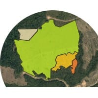
Conifer Vision automates forest inventory and analysis, collecting data on species, volume, and carbon storage.

Seamlessly access, manage, and visualise your ocean data with our intuitive cloud platform.

Hi-Tech & High Definition Weather Radar.

The Cities Indicators Dashboard measures key sustainability indicators, identifying challenges and tracking trends across cities for solution development.

UNDP GeoHub offers open-source geospatial data and tools for SDG decision-making and collaboration.

Protected Planet provides monthly updated, comprehensive data on global protected areas and OECMs from various sources


Leeana is the AI workspace that lets anyone run geospatial checks with confidence and at scale

Scientific Data is open to submissions from from all areas of natural sciences, medicine, engineering and social sciences

UN SDG Global Database offers 200+ indicators for worldwide countries.

Terrafuse AI predicts climate and weather risk more accurately, cheaply, and quickly.

Reports, statistics and forecasts on various topics including sustainability, AI, and transport.

Accurate and comprehensive weather platform for various applications.

Meteoblue provides accurate and reliable weather forecasts and industry-tailored climate solutions.

Meteomatics provides high-resolution and precise weather data for a variety of industries.

IISD conducts data-driven sustainable development research, publications, and policy news.

IEA's Database offers data on climate policies, clean tech support.
IEA datasets offer global and country-wise stats on energy, renewables, emissions, efficiency, transport, technology, weather, and investment.

Global GHG emissions insights platform.

Illuminem offers comprehensive sustainability and energy data.

Meteorological analysis tool to enhance post-storm evaluations by providing accurate precipitation analytics.

Thermal Intelligence Platform offers thermal anomaly detection and land surface temperature products.

Geospatial products facilitating the visualization and illustration of comprehensive weather insights in GIS applications.

Latent Lab utilizes AI to explore, synthesize, and visualize organizational knowledge.
Historical climate data analysis tool for risk assessment and planning.

Data science and AI for researching climate change policies and laws